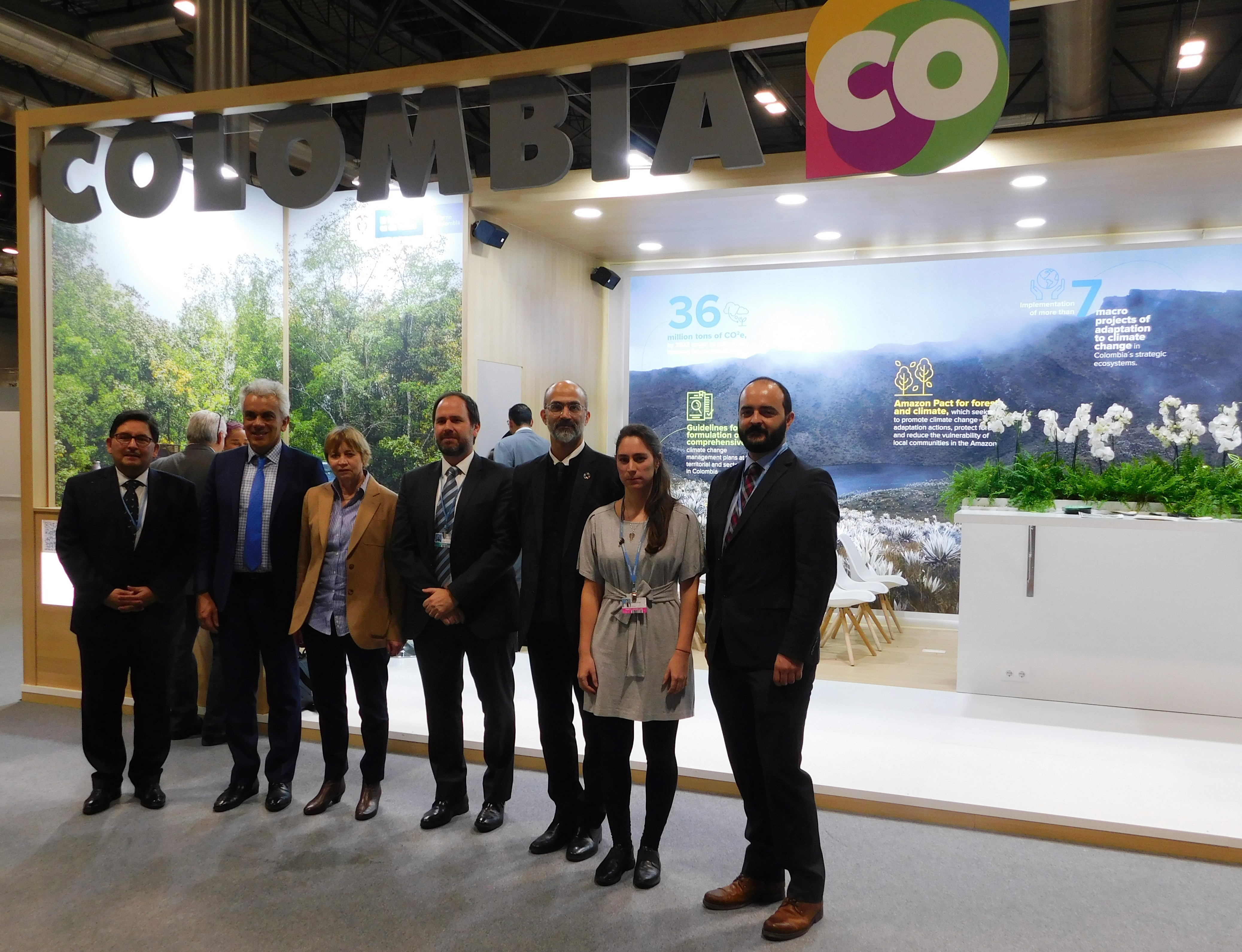
MIT delegation visit to San Miguel neighborhood, one of the areas heavily affected by the 2017 landslide. Mocoa, Colombia, 2018. Photo by Marcela Angel.
Drones for Equitable Climate Change Adaptation (DECCA): Participatory Risk Management through Landslide and Debris Flow Monitoring in Mocoa
2022 - 2025
NACERA
SIERA
UMERA
Project Team
Marcela Angel, Principal Investigator
Juan Camilo Osorio, Principal Investigator
John E. Fernández, Faculty Director
Norhan Bayomi, Technical Lead
Deepankar Gupta, Research Assistant, 2020-21
Daniel Adebi, Research Assistant, 2022-23
Anna Kaganov, Rapid Response Group, Summer 2023
Briana Ferro, Rapid Response Group, Summer 2023
Project Collaborators
Community Researchers Network (CRN)
Lucy M. Castillo
Edgar R. Torres
William A. Linares
Carlos A. Ramos
Carlos F. Díaz
Jairo Cárdenas
Nelcy A. Becerra
Corpoamazonia
Maritza Garzón
Alex Chindoy
Duber Rosero
Cesar Alban
Jhonny Gómez
CAF
Jessica Palomeque
René Gómez
Alicia Montalvo
MADS
Laura Bermúdez
Diana C. Pérez
Camila Gomez
Yaisa Bejarano
MIT Lincoln Laboratories
Sean Anklam
Madeline Chmielinski
John Aldridge
Airworks
Adam Kersnowski
David Morczinek
Supported By
Global Environmental Facility GEF
Awards
GEF Challenge Program for Adaptation Innovation, Global Environmental Facility, 2019
Marcela Angel selected as Big Bets Climate Fellow for her leadership of DECCA, Rockefeller Foundation, 2024
Participatory landslide monitoring system and risk reduction framework that combines Machine Learning (ML), Unmanned Aerial Vehicle (UAV) remote sensing, and multi-stakeholder engagement to map terrain susceptibility and promote community-based, inter-agency landslide monitoring and risk reduction strategies in data-scarce and climate-vulnerable regions.
Overview
Environmental threats are amplified by the effects of climate change, exacerbating intense pressures on underserved and socio-economically vulnerable communities that live and work in urban areas with compounding risks and vulnerabilities. In the city of Mocoa, located in the Colombian Andean-Amazon Piedmont in the Mocoa River watershed, landslides have been documented since the 1960s. In 2017, one of such events caused the death of more than 300 people and injured and displaced hundreds more. Today, the risk remains acute: 803 properties (6.01% of the urban area) are at risk of mass movements, 500 face flooding risks, and 1,925 are vulnerable to torrential floods according to the updated Basic Territorial Planning Plan. Notably, official estimates are locally contested and likely undercount the extent of the risks. Meanwhile, devastating landslides continue to affect the city’s infrastructure, creating drinking water and energy supply shortages, and triggering evacuations in 2018 and 2021.
The project Drones for Equitable Climate Change Adaptation (DECCA) aims to provide Mocoa with an effective and robust landslide monitoring system that combines local stakeholder engagement, pioneers new applications for Unmanned Aerial Vehicles (known as UAVs or drones) and Ground Control Points (GCPs), and develops innovative algorithms using machine learning and artificial intelligence for landslide detection and susceptibility projections. The combined approach aims to strengthen local capacities to engage diverse actors in developing the necessary social and technological infrastructure for community-based, inter-agency landslide monitoring and risk reduction strategies, promoting research and providing proof of concept on the use of unmanned aerial vehicles for equitable adaptation to climate change, and enabling local and national authorities to enhance their risk management capacity through the use of new tools and data.
Data collection in the Mulato River watershed and participatory-planning process in Mocoa, 2023. Video clips by Duber Rosero; video edited by Sophia Apteker.
Technological Innovation and Capacity-Building in Data-Scarce, Cloud-Covered Rainforests
DECCA developed an innovative, scalable, and technology-enhanced data collection and analytics workflow for landslide detection and susceptibility assessments. To better understand the primary drivers of landslide susceptibility in Mocoa, the project explored various machine learning methodologies, ultimately developing a highly accurate susceptibility model based on collected LiDAR data and key hydrological, geological, and geomorphological features. The resulting model—a calibrated Bayesian framework that preserves interpretability while enhancing sensitivity to landslide-prone areas—utilizes custom Python modules designed specifically for susceptibility modeling.
Key innovations of the workflow include a tailored multivariate Naïve Bayes classifier with feature-specific weighting optimized through the Covariance Matrix Adaptation Evolution Strategy (CMA-ES) to maximize predictive recall. To ensure long-term scalability, the framework utilizes a data-agnostic, reproducible inference model that applies trained architectures to new raster datasets, streamlining future data processing and allowing for the seamless integration of upcoming soil and weather datasets. Furthermore, the model incorporates advanced geospatial tiling and sampling strategies to significantly reduce spatial autocorrelation bias, leading to a more rigorous and realistic evaluation. Ultimately, this architecture achieved 85% recall, assigning high relative weight to critical hydrological and terrain features such as topographic wetness and stream power indices.


DECCA project components, ML methodology and features relative importance
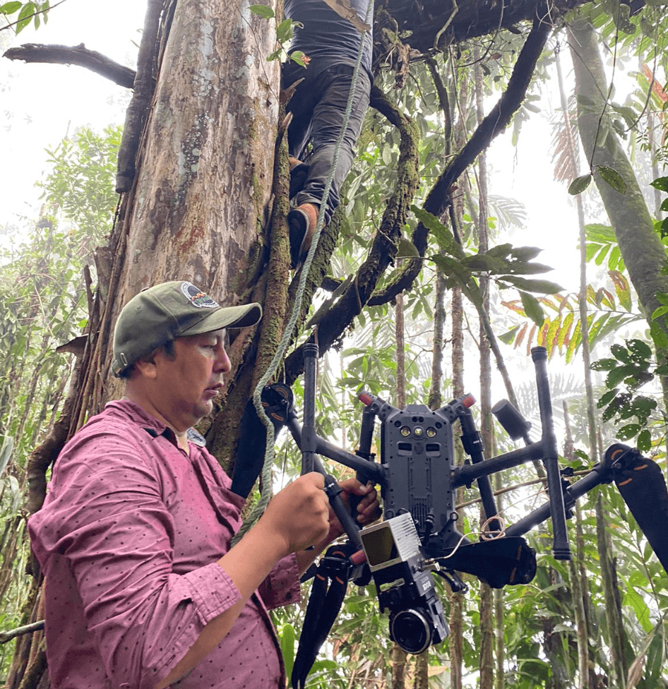
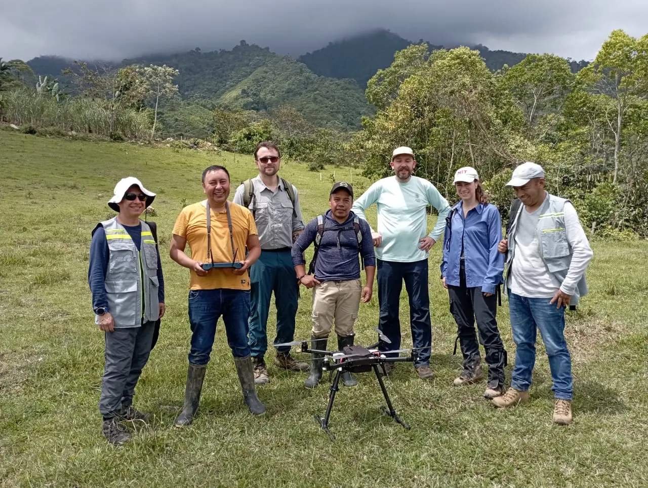
Recognizing the technical complexity of drone operations, AI modeling, and massive dataset processing, the project provided tailored technical training to Corpoamazonia, the primary local collaborator. A comprehensive five-module program focused on professional UAV data collection and processing, hands-on equipment troubleshooting, tool onboarding, and the design and testing of flight protocols for high-altitude, densely forested environments. This technology transfer and experiential learning process yielded 15 high-quality datasets while significantly strengthening the skills and confidence of three local pilots. By simultaneously generating high-resolution data for rapidly changing environments and building local monitoring technical and technological capacities, the project complements existing risk management efforts and addresses critical data gaps to update existing risk scenarios. At the local level, the resulting data collection protocols and technological infrastructure represent a vital asset for Corpoamazonia, strengthening their capacities to continue to monitor critical watersheds and reduce the uncertainties caused by regional data gaps in landslide risk management.


Training sessions for UAV data collection and hands-on equipment troubleshooting. Mocoa, 2023. Photos by Marcela Angel.
Participatory Governance and Community-based Planning in Mocoa
At the core of DECCA is a deep commitment to community engagement and participatory planning. The project was envisioned as an experimental pilot to foster a long-term local risk management culture. By maintaining a permanent dialogue with local, national, and international stakeholders, the project ensures that its high-tech ML models and data collection workflows are anchored in local priorities, creating a just, sustainable, and co-produced knowledge transfer protocol.
To achieve this, the project established three guiding outcomes: creating a participatory governance structure, engaging diverse publics across all project phases, and communicating progress and project results to adjust and refine project methodologies. These outcomes were operationalized through five parallel, evolving strategies:
The Community Researchers Network (CRN): A cornerstone of the project’s community engagement, the CRN was established as a seven-member working group balancing representatives across gender, sector, and ethnic backgrounds, including Indigenous, Afro-descendant, displaced communities and oversight groups. Meeting bi-weekly, the CRN drove on-the-ground outreach activities to anchor project goals in relation to local priorities; to refine implementation strategies in the context of other ongoing planning processes; and to evaluate project outcomes as perceived from the base.
The Advisory Committee (AC): To bridge the project's goals with institutional support, an ad hoc committee was formed comprising 27 representatives from local academia, the private sector, the CRN, and ten Colombian government and environmental entities (including the Ministry of Environment, UNGRD, and the Colombian Geological Service). Meeting seven times over the course of the project, the AC provided critical written and oral feedback regarding the use and interpretation of landslide susceptibility data, as well as user experience and functionality insights for the project’s data visualization platform.
Public Meetings and Community Workshops: In-depth site visits and immersions in Mocoa were structured around large public meetings designed to engage the general public, alongside targeted thematic workshops. These served as vital loops for sharing preliminary data, hosting external planning experts, and gathering direct public input to expand the scope of future project phases.
CRN-Led Targeted Outreach: Spearheaded by the CRN, the project maintained continuous, localized engagement with property owners within the study zone, ensuring a trusted local liaison was always accessible for residents seeking information about project activities.
Digital Assets and Community-Led Communication Materials: To ensure equitable access to project insights, the team developed a diverse suite of communication tools. Alongside an interactive digital data platform, the project produced CRN-led analog materials, including project fliers, infographics, a documentary video, and a technical glossary, ensuring that project information reaches all community members, regardless of their internet connectivity.


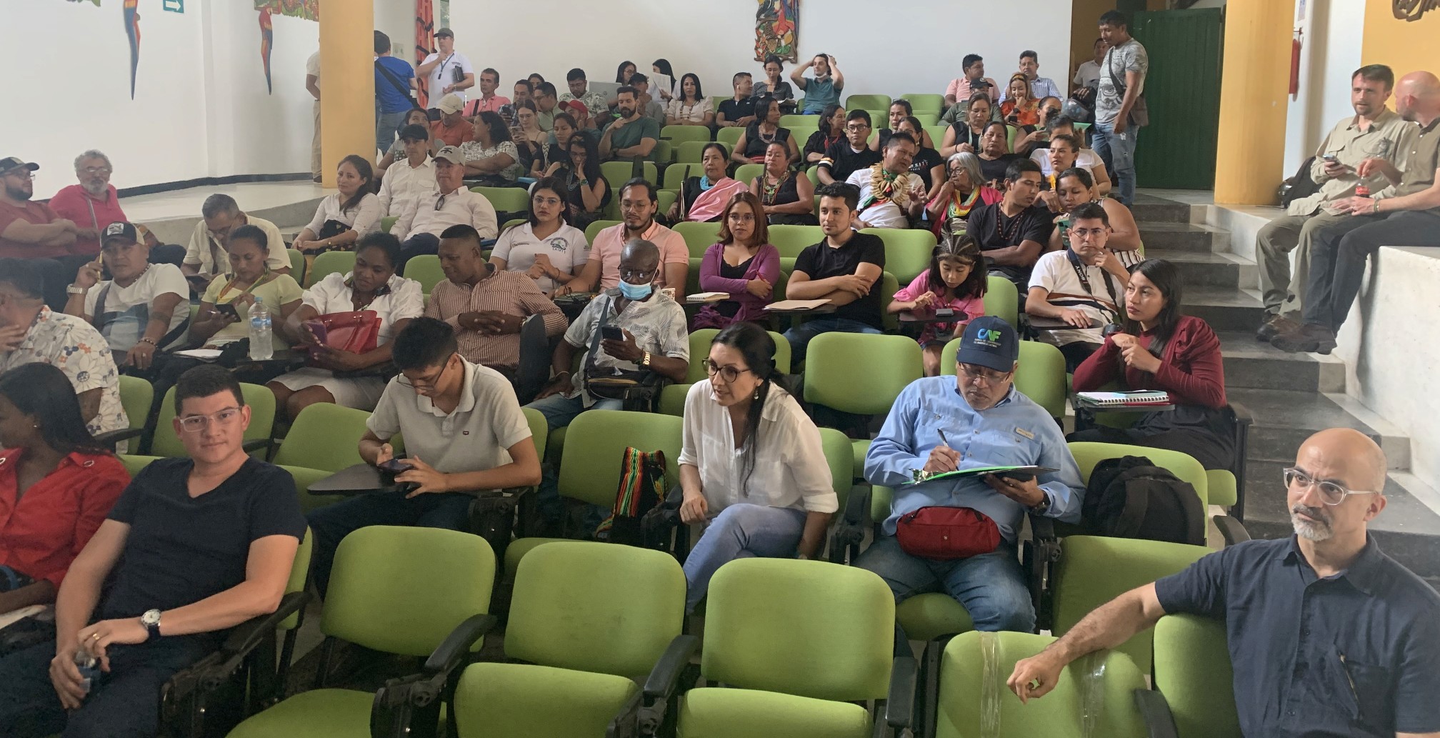


Community-outreach meetings and co-creation workshops. Mocoa, 2023. Photos by Juan Camilo Osorio, Madeline Chmielinski, Duber Rosero.
Together, the technology transfer, capacity-building, and participatory governance strategies leverage technical and social innovations to reduce vulnerability and build long-term climate resilience. By combining strengthened local institutional capacities with inclusive, community-based planning, the project ensures that high-resolution, up-to-date data is not only generated for landslide risk monitoring but also integrated into Mocoa’s local planning and risk management culture.
Related Publications
Related News